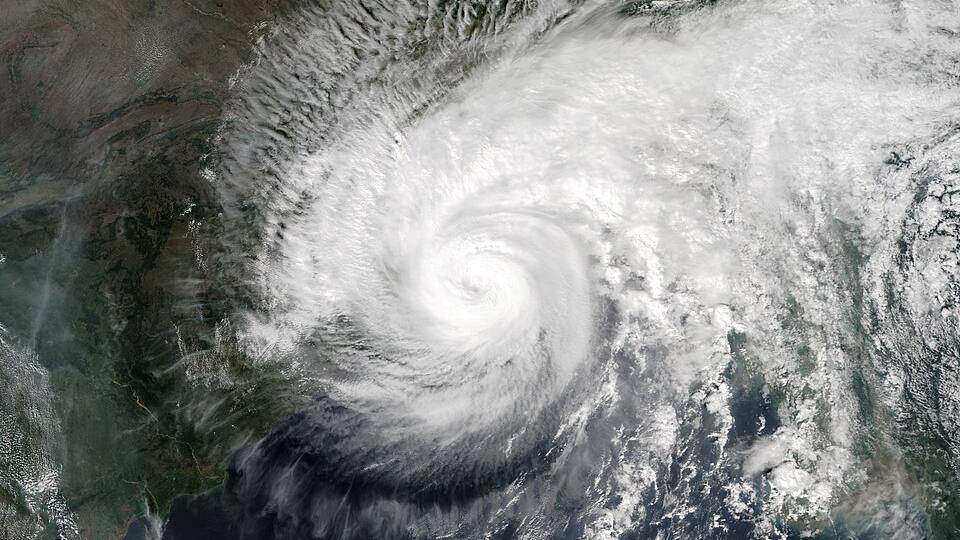
The depression over the Bay of Bengal has intensified into a deep depression, according to the India Meteorological Department's (IMD) National Bulletin No. 4, issued at 5.30 a.m. on Sunday, November 1, Hyderabad Mail reported. The system moved west-northwestwards at 23 kmph over the previous six hours and, at 5.30 a.m., lay over the southeast and adjoining southwest Bay of Bengal, centred near latitude 11.5°N and longitude 86.4°E — around 700 km east-southeast of Chennai, 770 km south-southeast of Visakhapatnam, 770 km southeast of Machilipatnam and 810 km east-southeast of Ongole.
Source: Hyderabad Mail / IMD Bulletin No. 4
The Hindu BusinessLine separately reported that the IMD is forecasting the system to strengthen into a severe cyclonic storm over the west-central Bay of Bengal by Monday, November 2, and to cross the south Andhra Pradesh coast along the 375-km stretch between Nellore and Narsapur in the early hours of Tuesday as a severe cyclone, packing sustained winds of 100–110 kmph gusting to 120 kmph. The system will be named Murasu, a name contributed by India, and would be the second cyclone over the Bay during the ongoing northeast monsoon season, the report said.
Source: The Hindu BusinessLine
What has changed since Saturday
Awaaz Punjab reported on October 31 that this system had concentrated into a depression off the Andaman Islands, with IMD Director General Mrutyunjay Mohapatra putting the likely landfall winds at 80–90 kmph gusting to 100 kmph. The IMD's November 1 bulletins raise that to severe-cyclone strength — 100–110 kmph gusting to 120 kmph — fix the landfall stretch between Nellore and Narsapur, and confirm the system has now reached deep-depression strength, having closed from about 830 km east-southeast of Chennai at midnight to about 700 km by 5.30 a.m. A separate Awaaz Punjab report on October 31 carried the Tamil Nadu warning for the same system under its coming name, Murasu.
Source: IMD via Hyderabad Mail and The Hindu BusinessLine
The IMD expects the deep depression to intensify into a cyclonic storm over the southwest and adjoining west-central Bay of Bengal within the next six hours, and into a severe cyclonic storm on November 2, Hyderabad Mail reported. BusinessLine reported that sea-surface temperatures of 29–30°C and low to moderate wind shear give the storm a favourable environment to keep strengthening, with some forecasting models pointing to possible rapid intensification in the next six to 12 hours.
Source: The Hindu BusinessLine
Heavy rain warning as Arnab-hit coast braces again
The approaching storm comes just days after very severe cyclone Arnab made landfall near Narsapur on October 28, and Murasu is expected to hit the coast just south of the areas Arnab battered, while recovery work is still under way, BusinessLine reported. The IMD has forecast light to moderate rainfall at many places in coastal Andhra Pradesh on Sunday with heavy rainfall at isolated places, rising on Monday to heavy to very heavy rainfall at a few places and extremely heavy rainfall at isolated places, followed by heavy to very heavy rainfall at isolated places on Tuesday, the report said.
Source: The Hindu BusinessLine
Rayalaseema is forecast to receive heavy to very heavy rainfall at isolated places on Monday and Tuesday, while Tamil Nadu and Telangana may see heavy rainfall at isolated places on Monday and Tuesday, and south Odisha heavy to very heavy rainfall at isolated places on Tuesday and Wednesday, according to the IMD outlook reported by BusinessLine.
Source: The Hindu BusinessLine