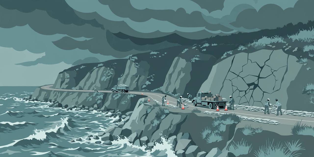
NEWPORT BEACH, California — Governor Gavin Newsom signed two executive orders on Tuesday, October 27, to prepare California for potentially dangerous El Niño storms — one devoted to Highway 1, the Pacific Coast Highway, and a second building on his September El Niño emergency proclamation to strengthen flood preparedness across the state. Newsom signed the Highway 1 order at Crystal Cove State Park in Newport Beach, where coastal erosion and a major bluff crack elsewhere in the park show the dangers already facing California's coastline, his office said.
Source: Office of Governor Gavin Newsom
The order directs state agencies to prioritise preventive work before storms hit, and to plan for the growing climate threats facing the highway beyond this storm season. A second order gives agencies additional tools — including emergency streamlining for storm-preparedness work — to reduce flood risks and protect communities and critical infrastructure, the governor's office said.
Why Highway 1, and why now
“Highway 1 is more than our nation's most iconic roadway. It keeps our coastal economy moving. It gets people to work, children to school, goods to local businesses, first responders where they're needed most, and visitors to our legendary beaches,” Newsom said. “We know what repeated closures cost these communities, and we're putting state agencies to work now to reduce the danger before storms hit.” In the same statement he attacked the federal disaster posture, saying Trump's FEMA is sending communities “a shameful message: when disaster strikes, you're on your own.”
The timing is not theoretical. California is already feeling El Niño's impact even though the event is not expected to peak until late November, according to the National Oceanic and Atmospheric Administration, as reported by CNN via KION Central Coast. Several Southern California communities have already been hit by flooding, coastal erosion and considerable damage from a series of Pacific tropical storms and hurricanes, along with a rare phenomenon called a Kelvin wave that raises sea levels. Near the signing site, emergency repair work recently shut down part of the Pacific Coast Highway after a large crack formed in a cliff under the highway between Newport Beach and Laguna Beach, CNN reported. Some forecasters predict this El Niño could be the strongest on record, CBS reported.
California Secretary for Natural Resources Wade Crowfoot said this year's conditions are “super-charged by an alarming marine heat wave off our coast that has already raised sea levels by a full foot,” and that agencies are “working around the clock with local, state and federal partners” — from reinforcing key portions of the Pacific Coast Highway to speeding approvals for priority flood and storm safety projects.
What the Highway 1 order actually does
The executive order creates a Highway 1 Task Force, led by the California State Transportation Agency and the California Natural Resources Agency, to prepare the corridor for El Niño storms and address longer-term climate threats. The task force will identify vulnerable stretches of the highway, recommend priority actions and funding needs, and find ways to complete preventive work faster, the governor's office said.
The order also directs Caltrans to prioritise landslide prevention where practicable, and directs State Parks to assess how closures and repairs could affect parks and public access. “Highway 1 is the gateway to many state parks and beaches along California's coast,” said State Parks Director Armando Quintero. “Cross-collaboration will be critical for visitor safety, public access, resource protection and emergency response.”
Cal OES Director Caroline Thomas Jacobs said her agency is putting the September emergency proclamation into action “by leading coordination among state agencies, preparing resources, and supporting our local partners,” to protect “vital routes like Highway 1, which coastal communities depend on to evacuate safely, connect with essential services, and receive help during emergencies.” Transportation Secretary Toks Omishakin said departments are strengthening vulnerable roadways and prepositioning critical equipment, and Caltrans Director Dina El-Tawansy said the order reinforces Caltrans' commitment “to protect travelers, support local communities and businesses, and keep this vital corridor open and safe.”
The stakes the state cites
Emergency project expenditures on the Big Sur Highway 1 corridor alone totalled approximately $312 million from 2020 through 2026, the governor's office said — the bill for repeated storm damage, landslides and closures along the state's most famous coastal road. Nationwide, major weather and climate disasters have cost more than $3.3 trillion since 1980, according to the Climate Central figures the governor's release cited. “The stakes are already clear,” the release said. “Today's action focuses on reducing risk before more damage occurs, especially by protecting the communities and businesses that bear the costs of repeated closures.”
What Caltrans crews are doing on the ground
Across California, Caltrans says it is inspecting known trouble spots, training crews and prepositioning equipment so response teams can act quickly as storms approach. Crews are clearing catch basins, ditches and culverts and checking pumps to keep runoff moving away from roadways; staging sandbags and sediment-control materials near vulnerable locations, including wildfire burn scars; checking snow-removal and avalanche-control equipment, emergency generators and fuel supplies; and preparing storm-response equipment at more than 120 maintenance yards statewide, with approximately 1,300 pieces of winter operations equipment available for deployment. Crews across all 12 Caltrans districts are ready to move to continuous storm coverage and 12-hour emergency shifts when needed, the governor's office said.
The California Highway Patrol urges drivers to prepare for rapidly changing conditions — flooding, landslides, debris flows and road closures. Its advice: check Caltrans QuickMap for closures and chain controls before travelling, slow down and leave more room on wet roads, avoid cruise control in wet conditions, prepare tires and wipers, use headlights when wipers are running — and never drive through floodwater, because standing or moving water can hide a damaged or washed-out roadway.
Background: what El Niño means for California
El Niño is the periodic warming of sea surface temperatures in the eastern Pacific Ocean, which reverses the usual pattern and changes circulation and precipitation worldwide. Its local impacts are unpredictable, but for California it often means more frequent and intense storms, producing dangerous flooding, landslides, debris flows and erosion, the governor's office explained. California has already experienced coastal flooding attributed to El Niño this year, as Kelvin waves raise sea levels and offshore Pacific hurricanes, fuelled by the warm eastern Pacific water, drive strong waves against the coast.
What this means for residents — and what happens next
For the Punjabi and wider South Asian families who live along the coast and in the Central Valley and who drive California's highways daily — including truckers whose freight routes on US-101, I-5 and SR-99 fill with detour traffic whenever coastal roads close — the practical message is preparation, not panic: the state is trying to keep Highway 1 open through the storm season, but closures, when slides or flooding hit, can still come with little warning. Next, the new task force must name the corridor's most vulnerable stretches and its priority actions and funding needs, and Caltrans' preventive work must be in place before El Niño's expected late-November peak. Awaaz Punjab will track Highway 1 closures and storm damage through the season.
What is solid
- Governor Newsom signed two executive orders on October 27 — one for Highway 1 and one building on his September El Niño emergency proclamation — at Crystal Cove State Park in Newport Beach (Governor's office; CNN via KION).
- The Highway 1 order creates a task force led by the state transportation and natural resources agencies, directs Caltrans to prioritise landslide prevention, and cites about $312 million in emergency spending on the Big Sur corridor from 2020 through 2026.
- Caltrans is prepositioning equipment at more than 120 maintenance yards with about 1,300 pieces of winter operations equipment, and its 12 districts are ready for continuous storm coverage.
What is only claimed
- Forecasters cited by CBS predict this El Niño could be the strongest on record — a forecast, not a certainty; NOAA expects the event to peak in late November, and local impacts remain unpredictable. The governor's criticism of federal FEMA policy is his political characterisation, presented as his statement.