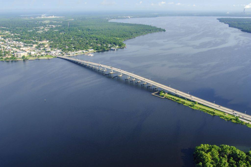
The St. Johns River west of Cocoa is in moderate flood and is forecast to rise slowly into major flood stage this weekend and into early next week, the National Weather Service in Melbourne warned on Saturday, November 7, keeping a Flood Warning in effect “until further notice” for Brevard County. At 17.2 feet, the Weather Service says, water enters homes — and the river was already at 16.9 feet on Saturday morning, less than half a foot below that mark.
Source: National Weather Service, Melbourne FL — Flood Statement, Sat Nov 7, 10:53 a.m. EST
The warning covers the St. Johns River near Cocoa 9W — the gauge nine miles west of Cocoa — where “exceptional rainfall over the headwaters of the St. Johns River has caused moderate flooding,” the Weather Service said. The flood is the second wave of the same disaster that opened the month: record rain on November 1–2 — a single-day record of 11.03 inches at Melbourne, with more than 20 inches reported at Palm Bay in local coverage — drowned Brevard County streets first, and is now draining into the slow river system all at once.
Source: National Weather Service, Melbourne FL
Exactly where the water goes at 17.2 feet
The Weather Service's impact statement for the Cocoa gauge is specific. At 17.2 feet: water enters homes along the St. Johns River in the Lake Poinsett area west of Cocoa; low-lying homes in the Silver Pines subdivision in Rockledge and the Shakespeare Park area of Cocoa are affected; the Providence Road area west of Cocoa becomes impassable, cutting off access to homes in the Mullet Lane and Bass Road area; docks are flooded; and water stands in the parking lot at the Lone Cabbage Fish Camp. WKMG News 6, Orlando's CBS affiliate, has reported that residents along this stretch are bracing for flooding that could rival Tropical Storm Fay.
Cocoa is not the only gauge under warning. The St. Johns near DeLand, affecting Lake and Volusia counties, was at 3.9 feet at 9:30 a.m. Saturday against a flood stage of 4.0 feet, with minor flooding forecast and a rise to 4.4 feet expected early Thursday. The river above Lake Harney, in Seminole County, is in moderate flood — at 9.5 feet there, water begins to move into homes in low-lying areas and flooding spreads around the Black Hammock area near Lake Jesup. A separate warning covers the river near Sanford. On Florida's west side, the Peace River at Arcadia in DeSoto County stood at 16.0 feet on Saturday morning against a bankfull stage of 10.0 feet, a level at which the Weather Service says up to 60 homes at River Acres are flooded.
Why the river rises a week after the rain stopped
The St. Johns is one of the few major American rivers that flows north, running about 310 miles from its headwaters in the marshes west of Vero Beach to Jacksonville — and it drops only about 30 feet over that whole distance. On land that flat, floodwater does not rush away; it spreads, ponds, and drains over days and weeks. That is why Brevard County's emergency has changed shape rather than ended: the street flooding of November 1–2 has become a river flood whose crest, on the Cocoa reach, is still ahead of residents this weekend and early next week.
For the families in the Lake Poinsett, Silver Pines and Shakespeare Park areas, the practical meaning of “major flood stage” is water inside homes that sit near the river, roads — Providence Road first — becoming impassable, and access to the Mullet Lane and Bass Road homes cut off. For drivers and truckers crossing the Space Coast, the State Road 520 corridor between Cocoa and Orlando runs through this same low river country west of Cocoa, and the Weather Service's standing instruction applies across all of it: do not drive around barricades or through flooded roads, and use caution near riverbanks. “Turn around, don't drown when encountering flooded roads. Most flood deaths occur in vehicles,” the Weather Service's Tampa Bay office wrote in its Peace River statement on Saturday.
The Weather Service expects the Cocoa gauge to keep rising slowly into major flood stage this weekend and into early next week, and the Flood Warning stays in effect until further notice. The next scheduled flood statement is Sunday morning at 11:30 a.m. EST. Residents in the named areas should watch that statement and Brevard County emergency updates, move valuables above the 17.2-foot impact level, and plan around Providence Road becoming impassable.
No new evacuations had been announced in the Weather Service statements as of Saturday afternoon, and the statements do not report injuries from the river flooding. Awaaz Punjab covered the first wave of this flood — the November 1–2 deluge that closed Brevard schools and moved polling places — and will update this story as the river crests.