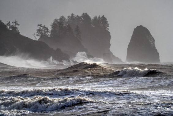
The National Weather Service in Seattle has issued an updated high wind warning for the Northern Washington Coast and the Grays Harbor County Coast, in effect from 4 p.m. Saturday, November 7, until 4 a.m. Sunday, warning that south winds of 25 to 35 mph with gusts up to 60 mph will hit the coast on Saturday evening — strong enough, the service says, to blow down trees and power lines and cause widespread power outages. The updated warning was issued at 2:01 a.m. Saturday, upgrading the high wind watch that had been in place for the same stretch of coast.
Source: National Weather Service, Seattle
“Damaging winds will blow down trees and power lines. Widespread power outages are expected. Travel will be difficult, especially for high profile vehicles,” the Weather Service said in the warning, urging people to secure loose objects that could be blown around or damaged. The strongest winds are expected on Saturday evening. The warning covers the Pacific-facing coast of Grays Harbor County — including the Ocean Shores and Westport areas — and the northern coast toward the Olympic Peninsula.
Source: National Weather Service warning text, via The News Tribune
A second high wind warning from the National Weather Service in Portland covers the South Washington Coast and Oregon's Clatsop and Tillamook county coasts from 3 p.m. to 11 p.m. Saturday, with the same forecast of south winds 20 to 30 mph and gusts up to 60 mph — meaning almost the entire Pacific coastline of Washington and northern Oregon is under a high wind warning for Saturday evening at the same time.
Source: National Weather Service, Portland
A potent front, arriving after dark
KIRO 7 News Seattle's forecasters say a potent low-pressure system moving toward the British Columbia coast will swing a wet and windy front through Western Washington on Saturday evening and Saturday night. Saturday daytime, including the University of Washington Huskies game, is expected to be mostly dry, cloudy and unusually mild, with highs in the lower 60s — but conditions deteriorate quickly after dark. The winds with this front could be the strongest of the fall so far for some areas, KIRO 7 reported, and because leaves are still on some trees, falling limbs and outages are a particular risk.
Source: KIRO 7 News Seattle
Inland, the warning does not apply, but the gusts will still be felt: spots around Puget Sound could see gusts topping 40 mph, and the strongest burst of wind along the Interstate 5 corridor is likely mainly after 9 p.m. Saturday night, according to KIRO 7. Rain will be heavy at times with the front — a quick quarter- to half-inch in many spots and more at the coast — and forecasters warn of brief urban flooding Saturday night where fallen leaves clog storm drains. Weather.com's Grays Harbor County forecast showed rain chances reaching 100 percent on Saturday evening with around an inch of rain possible across the day.
Offshore: storm warnings and very rough seas
The same system has triggered marine warnings all along the Washington coast. The Weather Service has a storm warning in effect for the coastal waters from Cape Flattery to Cape Shoalwater from Saturday morning to Sunday morning, with south winds of 30 to 40 knots, gusts to 50 knots, and seas building to 21 to 28 feet offshore — conditions the service says could capsize or damage vessels. A gale warning covers Grays Harbor Bar, where ebb currents peak on Saturday afternoon and again early Sunday. Small craft advisories run through Sunday afternoon. Anyone planning to be on or near the water this weekend is being told to stay in port.
What drivers — especially truckers — should know
The Weather Service's warning that travel will be difficult “especially for high profile vehicles” is aimed squarely at trucks, buses and vehicles towing trailers: a single strong gust can push a high-sided trailer across a lane or onto its side. The exposed coastal highway, U.S. 101, runs the length of the warning area through Grays Harbor County, and the I-5 corridor through Puget Sound will see its worst gusts after 9 p.m. Saturday. For the many Punjabi-American truckers who run I-5 between Seattle, Tacoma and Portland, the practical advice from forecasters is to keep both hands on the wheel, slow down, keep distance from other high-profile vehicles, and — if a load can wait — consider clearing the coast and the corridor before the evening peak or after the front passes early Sunday.
The National Weather Service advises: secure or bring in loose outdoor objects; charge phones and battery packs in case of an outage; never touch or drive over downed power lines — report them instead; if you live in a mobile home, identify a sturdy building you can move to before the winds peak; and keep monitoring updated forecasts, because warning times can shift as the front speeds up or slows down.
The second blow in three days — and more coming
This is not the coast's first wind event of the week. The same Grays Harbor coast was under a wind advisory on Friday, with south winds of 20 to 30 mph and gusts to 50 mph, as an earlier system moved through; one windy system is exiting as the stronger one arrives, KIRO 7 noted. And the pattern does not end on Sunday: rain and wind taper on Sunday morning into a cooler, blustery afternoon, a brief dry break follows on Sunday night and Monday, and then the Weather Service describes an active pattern for the rest of next week, with additional Pacific storms bringing more wind and lowland rain to Western Washington.
What happens next
The Seattle office's high wind warning expires at 4 a.m. Sunday and the Portland office's at 11 p.m. Saturday, after which utilities will assess damage and restore power where outages occurred. Forecasters will update the warnings through Saturday as the front approaches; if observed gusts run stronger or weaker than forecast, the warning area and timing can be adjusted. Residents should check the latest Weather Service statements before travelling on Saturday night, particularly on U.S. 101 and I-5.