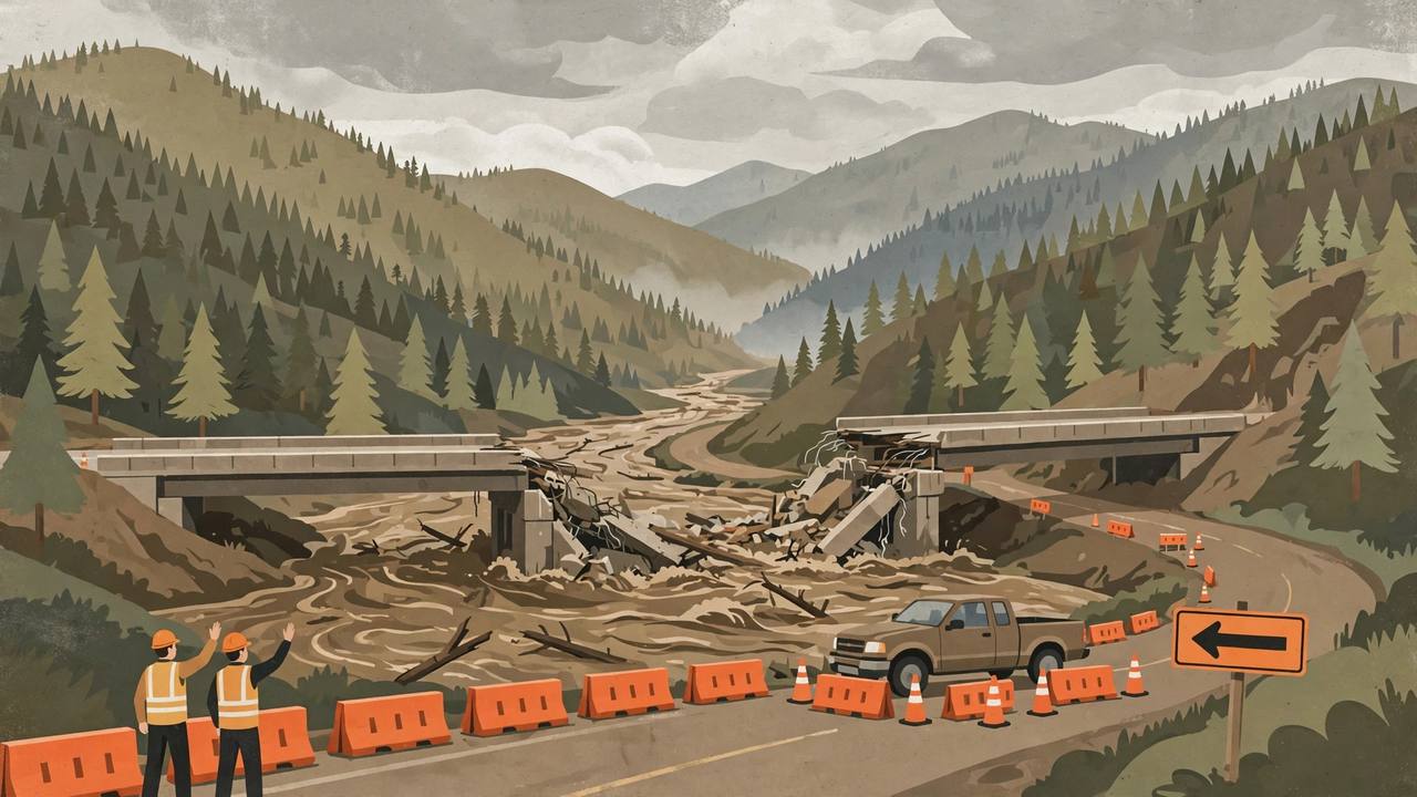
The flood story in southwest Colorado has turned into a highway story. The U.S. Highway 160 bridge over the Piedra River, 18 miles west of Pagosa Springs in Archuleta County, has failed: its piers collapsed in the weekend flooding, a section of the bridge is gone, and the Colorado Department of Transportation (CDOT) says the bridge will have to be rebuilt, with a temporary bridge to be installed as soon as possible. Awaaz Punjab reported the weekend's record river crest and evacuations on November 1; in the two days since, the damage has hardened into a full inventory of washed-out lanes, sinkholes, mudslides and closures across the region's main east-west highway, and Pagosa Springs is largely cut off, with U.S. 160 closed on both sides of town and only one rural highway still open south toward New Mexico.
Source: Colorado Public Radio via KSUT (Nov. 2, 2026)
The clearest picture of the danger came in a video shared on Monday, November 2, by Colorado Parks and Wildlife's southwest region: a pickup truck driver went through a CDOT roadblock and kept driving toward the collapsed Piedra River bridge, stopping only as workers waved their arms and shouted, then reversing away from the gap. 'Don't be the person who blows through a Colorado Department of Transportation roadblock and almost drives into the Piedra River where the bridge over US 160 no longer exists. Despite our patrols blocking roads, this still almost happened,' the agency wrote.
Source: Colorado Parks and Wildlife, via CDL Life (Nov. 3, 2026)
CDOT's damage list, highway by highway
On Tuesday, November 3, CDOT published its fullest account yet of what the back-to-back El Niño rainstorms have done to the region. On Wolf Creek Pass, the 33-mile closure from north of Pagosa Springs to South Fork (mileposts 150 to 183) holds at least three separate emergency-repair sites: at MP 150, five miles north of Pagosa Springs, a failed culvert opened a sinkhole in the roadway; at MP 161, torrential runoff damaged the retaining wall that supports the highway near the Wolf Creek Valley Scenic Overlook; and between MP 155 and MP 170, mud and rockslides up to six feet high have crossed the highway in several places. In the Narrows, MP 175 to 180, flooding from the South Fork of the Rio Grande undercut the highway in the October 22 storm, and the November 1 flood washed out an additional segment of road.
Source: CDOT road conditions, via Alamosa Citizen (Nov. 3, 2026)
West of Pagosa Springs, the 30-mile stretch of U.S. 160 toward Bayfield alone has at least five damaged locations: the failed Piedra River bridge at MP 121; undercutting by Devil's Creek at Devil Mountain Road, MP 124, fifteen miles west of town; a destroyed eastbound lane at MP 135 in the Sheep Springs area, where Martinez Creek flooded and a construction crew has already begun rebuilding the embankment and shoulder; and rockfalls and mudslides blocking lanes across Yellow Jacket Pass, MP 114 to 118. Downtown Pagosa Springs itself is under a safety closure for evacuation and emergency work, and the town's San Juan River bridge will be inspected once the water recedes — floodwaters also washed away the ground under the Pagosa Springs Museum. South of Chimney Rock, Colorado Highway 151 (MP 27 to 30) took additional damage inside an existing emergency work zone, including a complete washout on November 1 about four miles south of the U.S. 160 junction. North of Durango, U.S. 550 at MP 32 is being watched at the Hermosa Creek Bridge, where high water and debris flows may threaten the structure; a bridge inspection must be completed before it can safely reopen. Crews are also working on U.S. 285 north of Monte Vista, State Highway 112 north of Del Norte, and State Highway 17 west of Antonito, where the 39-mile stretch to the New Mexico line has a failed culvert at MP 3 and shoulder damage and undercutting near La Manga Pass at MP 15.
A town cut off, and rivers at historic levels
The second flood round, falling on the weekend of October 31–November 1 on ground still damaged by the October 22–25 floods, pushed the San Juan River at Pagosa Springs to a crest of 16.81 feet on Sunday evening — about a foot below the all-time record of 17.8 feet set in 1911. In Durango, the Animas River ran at nearly 13,000 cubic feet per second, about 50 times its typical flow, filling homes and yards with feet of water and mud. Colorado's Division of Homeland Security and Emergency Management kept the State Emergency Operations Center at Level 1, its highest activation, on November 2, with 12 counties affected. The Red Cross has opened three evacuation shelters across the region. The entire community of Manassa, which flooded the previous week, was told to evacuate; its restaurant owner told CPR many locals stayed, and his business was mostly continuing as usual. Wolf Creek Ski Area, which had opened on Halloween, has shut again because the roads are impassable, and the Durango and Silverton Narrow Gauge Railroad says flood damage to its tracks between Durango and Hermosa on Sunday will be repaired in time for winter trains later this month.
Source: The Weatherboy, with Colorado Sun and Pagosa Springs SUN reporting (Nov. 3, 2026)
Along the Rio Blanco River south of Pagosa Springs, the water swamped the Last Resort on the River Campground, consuming every riverside campsite and flooding three structures; families who live there full-time had to leave trailers behind. Owner Brandi Webb estimated she has issued about $5,000 in refunds. 'It leaves you in awe of how quickly things can change and how powerful the water itself is,' she told CPR. In Pagosa Springs itself she described neighbours sharing Wi-Fi, checking on each other's goats and horses: 'So as much as we are feeling isolated, we know that we're not alone.' Archuleta County spokeswoman Vicki Shaffer said county teams spent Monday on reconnaissance missions looking for people who might be trapped by high water or washed-out roads and bridges.
Why this highway matters — freight, supplies, medicine
U.S. 160 is not a scenic detour in this corner of Colorado; it is the region's supply line, running east-west across the southern tier of the state. CDOT's southwest-region spokeswoman Lisa Schwantes put it plainly: 'This is how we get our freight, our supplies, our medical needs. It's how we get our tourists and visitors that visit the area — that is a huge economy for us,' she said, adding that the roads are also vital for moving hay and livestock for the agricultural communities across the region. CDOT Regional Transportation Director Julie Constan said the agency is 'particularly focused on getting US 160 open for the community of Pagosa Springs' as the town begins its recovery. Executive Director Shoshana Lew said the first order of business is 'to get them open before winter hits' — a real deadline on Wolf Creek Pass, one of the highest and snowiest crossings in Colorado.
If your route crosses southern Colorado or the Four Corners, treat U.S. 160 as closed, not delayed: Wolf Creek Pass is shut for 33 miles, the Piedra River crossing west of Pagosa Springs no longer exists, and U.S. 550 north of Durango, U.S. 285, CO 151, CO 112 and CO 17 all carry closures or emergency work zones. The pickup driver in the Parks and Wildlife video stopped feet from a missing bridge — never go around a roadblock on a flooded highway, because a washed-out section can be invisible until you are on it. CDOT directs drivers to COtrip.org for live state-highway conditions, and neighbouring-state conditions are on NMroads.com, AZ511.gov and udottraffic.utah.gov.
What happens next
Three timelines now run in parallel. First, the temporary fix: CDOT says a temporary bridge will be installed at the Piedra River 'as soon as possible,' and CPR reports the agency expects a workable replacement within a week or two — but the permanent bridge must be rebuilt, and no date for that has been given. Second, the money: the $6.5 million in federal quick-release funds and $5 million in state contingency money are only a start against damage CDOT preliminarily estimated at $65 million for federal-aid roads from the October flood alone, before this second round is fully counted; on Saturday, Governor Polis requested federal disaster funds for the earlier floods. Third, the weather: the National Weather Service says the rain has mostly stopped, a quick storm may bring high-elevation snow and light rain on Wednesday, and rivers of concern should keep falling over the next few days, forecaster Gillian Harrison told CPR — which means the region's next fight is not water, but winter arriving on broken roads. Awaaz Punjab will update the closure list as CDOT reopens segments.